Flachau Tiefschnee 2024

Tiefschnee Abfahrt in Flachau 2024

Kamera: GoPro Hero 3 (~2017)
Selfie-Stick: minimalistisch + Schnur zur Unterstützung
Music: Soul Surfing by Kasket Club
Strecke: Grießenkar Gipfelkreuz – Grießenkaralm – am Grat – Wanderweg – Forststraße

Grießenkaralm:
GPS Altitude : 1829.001
GPS Latitude : 47.3200399722222
GPS Longitude : 13.3600499722222

Pilgerfahrt nach Mariazell Tagebuch 1

Wir Sauermann Brüder und Vater pilgern gerade nach Mairazell. Gestern sind wir von Schneebergdörfel gestartet.

Im Zug noch schnell übers N70 einen Account bei Geocaching.com gemacht. Dann Aufstieg zur Mittelstation Schneebergbahn, Buchteln Essen. An der geschlossenen Lackabodenhütte vorbei. Durch die Eng/Lackabodengraben runter-umgestürtzte Bäume säumen den Weg und dann blockieren die Stämme auch das fortkommen.

Nach Peyerbach, Konditorei Nöbauer in Reichenau, Ende auf der Speckbacherhütte beim vorher telefonisch bestelltem Schweinsbraten.

Sportlich

geo markup of photos

I was on a sailing holiday at the beginning of February, ten people on a catamaran in the Carribean. Thanks to sailing, we had an Offshore Navigator on a laptop, recording the positions with a GPS mouse.

Using this GPS track and the photos taken with our two cameras, I was able to create a KML file from the journey. I used some custom PHP code I have written, a little MySQL/PHP/FlickrApi/GoogleMaps hack. It took two days to hack, which is quite nice. Included is a photo annotator to place pictures with some productivity tools (copying the position from one picture to another).

The first result is a Google Earth KML file. It shows the track of the boat and the pictures from Flickr. The other crew members don’t have flickr accounts… yet.
google earth view of the tour

Second, I wrote another script that sets the needed geo-tags on flickr based on the geocoding. See my flickr map.
flickr map of the tour

Now that I have the code, I would love to go on with these things. Is there an open source project which dedicates itself to such mashups? We could also use Chris Bizer and Richard Cyganiaks D2RQ to make a sparql-endpoint for geo positions. Who is in?

Is there an API for plazes.com? So many things to do 🙂

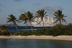
Matatour 2007 – chilliger carribean Törn

IMG_3690

This entry in german, as most people involved are german speaking… non-german speakers enjoy watching the video or the pics.

Wie schon angekündigt, waren wir von 27.1.2007 bis 11.2.2007 auf einem Yacht-Törn in der Karibik. Wir sind in Martinique mit einem Katamaran gestartet, dann mit vielen Stops in den Süden und zurück. Jeden Tag Sonne, Palmen, Segeln, viel Regen und karibisches Essen.

Continue reading “Matatour 2007 – chilliger carribean Törn”